


Click on image for pdf
Location: Bob Marshall Wilderness, Montana
Entry/Exit Point: Silvertip TH, Hungry Horse, MT
The drive along Hungry Horse Reservoir, just outside of Kalispell, MT built up the excitement for the adventure ahead. The bumpy, gravel road following the windy shore of the resorvoir allowed our group members to meet, and begin to leave behind our busy, everyday lives for a chance to backpack for five days in the Bob Marshall Wilderness. The Bob Marshall Wilderness complex is the 3rd largest wilderness area in the contingent US, full of biodiversity and solitude. Nothing like warming up our laughing muscles at 7 in the morning with 3x espresso shot coffee before we had to warm up our hiking muscles. The track that we completed was a ‘lolli-pop’ loop, with a slight detour from our original planned route. The route was ‘about’ 50 miles, summarized below and attached as a pdf here.
Day 1- We started at Silvertip Trail Head and hiked into Pentagon Cabin along Spotted Bear River. This was a relatively easy cruise. We camped at the Pentagon Cabin, where there was a BMWF Trail Crew also camped there working hard to clear the trails. Beyond the cabin there were other camping spaces. This area seemed like a well used camping spot as there are multiple trail options from here.
Day 2- Hiked uphill from Pentagon Cabin to Switchback Pass, crossing multiple streams flowing with water despite the dry summer conditions. The views from Switchback Pass were worth the uphill climb, over downed tree after downed tree. The trail down from the pass to Dean Lake was STUNNING (and windy)! The acient, uplifted reef terrain became evident. Wildflowers were in full bloom. We had a windy evening at Dean Lake, which seems pretty common for the area. Any amount of wind and the views would have been worth it, but waking up with dirt in my mouth at 3 am… not so much.


Day 3- The description of the day started as “This was the most beautiful section of trail that we hiked.” But then realized Day 4 required (kind of) the same definition... Elevation is lost on the trail from Dean lake to Pentagon Lakes along a massive rock wall. Amongst the burn area, the fireweed was flowering to create a beautiful contrast between the bright pink flowers with the black charred tree trunks. Some ups and downs beyond the Trilobite Lakes leads to the trail junction where we started to head back down to Dolly Varden Creek. Finding camping along Dolly Varden creek took some patience and exploration. There is one open meadow about .75 miles from when the trail junctions along the creek, which showed light evidence of a previous camper’s spot. So that’s where we spent the evening! The trail along Dolly Varden Creek was well defined, but through some beary thick forest.


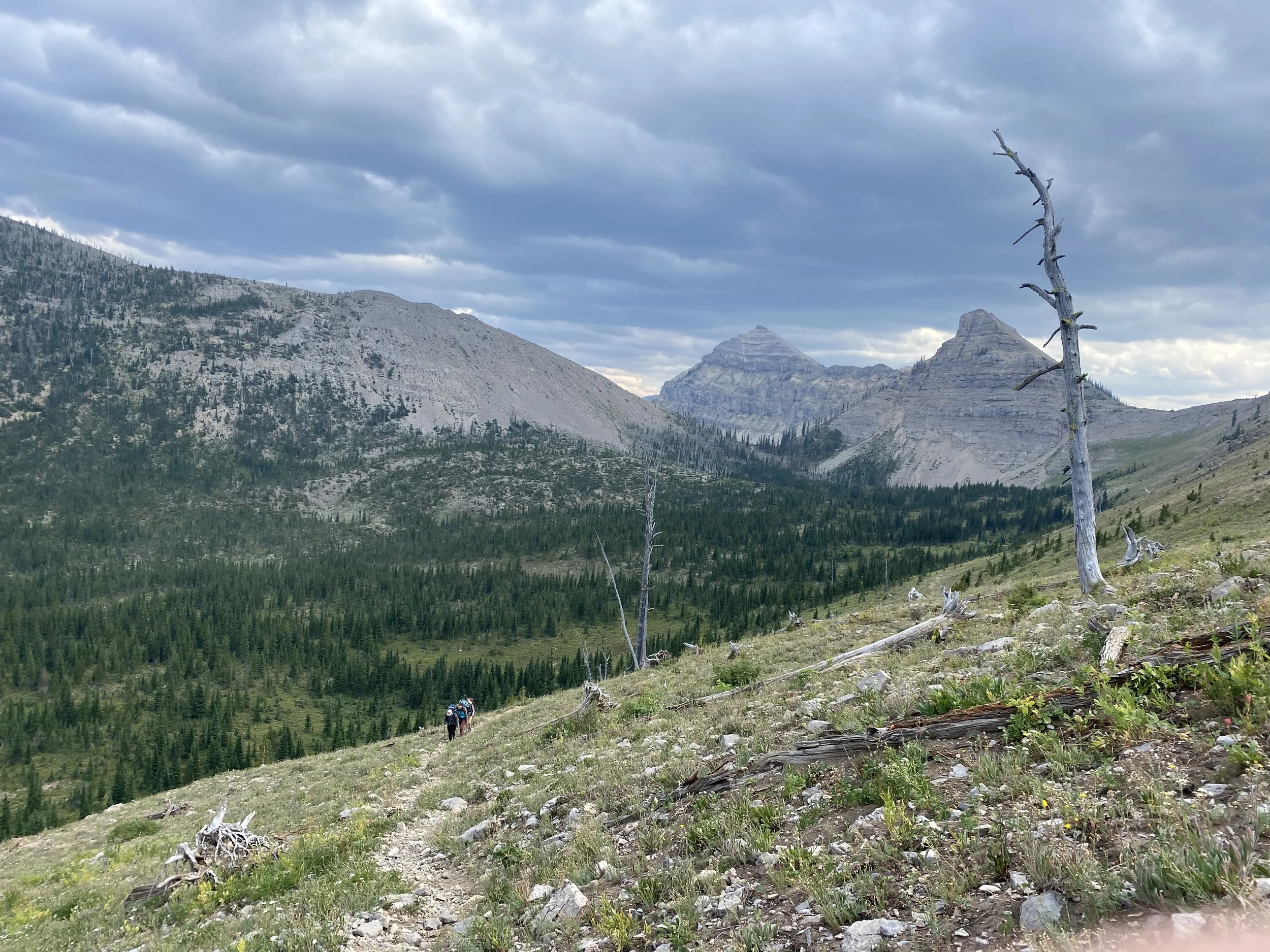
Photo Credit: Sally Stecher
Day 4- A midinght rain on the tent brings initial feelings of safety that the bears are probably sleeping and comfort while drifting back to sleep in a warm bag. When its still raining as the sunrises, those feelings quickly dissapate to a curiousity of how the day is going to go. As any cold, rainy day should start while camping- first step was hot drinks and communication via yelling from tent to tent as to what we were going to plan for the day. An early August rain was a little shocking and chilling for our group, so we packed up and got moving right away from our spot along Dolly Varden Creek. Our hopes of the uphill bringing us warmth wasn’t quite effective because it was so cold and continuing to pouring rain. There were puddles that were 8-12” deep along the trail, so head to toe, we were all soaked. We made it to the Pentagon Creek Pass and were faced with our first major route decision of the trip. The original plan was to head up the peak to the S of Pot Lake (elevation 7775’). This trail was labeled on the Caltopo map, but not on the printed map we had. There was a defined trail at first, but as that disappeared, we continued up the ridge. The rain began to clear up (thank goodness!) and we had stunning views of Pot Lake. The geology changed to include dramatic red rocks surrounded by green forests. We thought we had been transported. After evaluating the terrain at the top, we decided the best option for the group was to turn around, descend to the pass and go down Pentagon Creek. As we trekked down, we could see some dark, bubbly storm clouds heading back our way. Luckily, we made it down the pass and were following along Pentagon Creek and only expeienced a few rain drops. The terrain in the Bob has a large impact on local weather conditions; this time we were protected from the weather, so we continued hiking over downed trees and remained damp. There are not many camping opportunities along Pentagon Creek, and at points the creek seemed to ‘disappear’ and must have been flowing underground. We camped at the Pentagon Creek and the East Fork Junction. This was a very developed site with tie-ups for horses. A quick dinner in the dark allowed us the chance to refuel from the grueling day and then climb into our bags to finally find some warmth and rest.

Photo Credit: Sally Stecher
Day 5- An early morning start got us on the trail. Nothing like starting a day on the trail with a chilly, creek crossing! To return to the trailhead, we hiked along Pentagon Creek, connecting back to where we had been a few days earlier. We saw lots of tracks, other wet groups, and the same trail crew on the ~10 miles out… we all had to dry out after that storm. Passed by Pentagon Cabin again, and cruised out along Spotted Bear River to Silvertip! The bittersweet retun to the parking lot highlights the gratitude of the experience and the initial intentions set. This route was a great way to experience multiple types of ecosystems, a trail with balanced elevation increases and decreases, and find solitude.

“The trees, the rain, the wind can be the quickest vine of connection to BEING.”
~Anon.