


Start Trailhead: Fielding/Coal Creek Trailhead in Glacier National Park
End Trailhead: Near Goat Lick Parking Lot or 48.238634, -113.518174
Distance: Approx. 10.5 miles (or less), 5500’ Gain
Difficulty: Hard
Note: This route has many options to get back to Hwy 2, all in avalanche terrain.
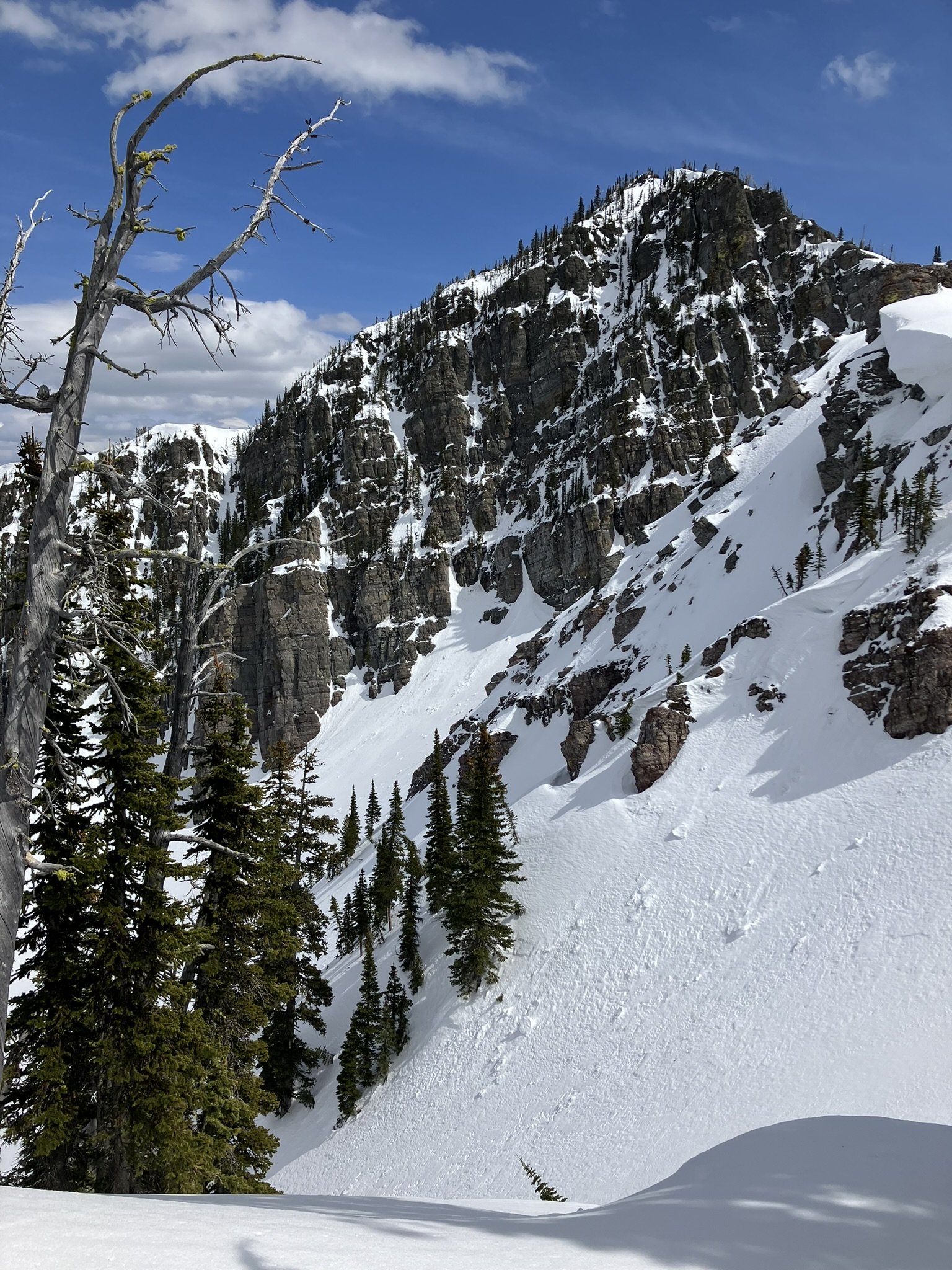
One of the best (long) day trips in the area is the Running Rabbit Traverse, which travels through the most southern portion of Glacier National Park. The views are incredible, expansive and change with every section of the route. This voyage should not be attempted in low snow stability due to the consequential terrain and essentially every exit is a terrain trap back to the highway. From the parking spot at the Coal Creek Trailhead follow the obvious ‘road’ through the thick trees to the railroad tracks. Cross the tracks and follow them for about .5 miles to the ridge going all the way up to ‘Sub-Shields’. Navigate through the trees to catch the ridge and from there it is consistent climbing. You will be able to see a lot of the route as you get higher up.
Once you reach sub-Shields, you will do your first downhill to the pass between Sub-Shields and Mount Shields. Wolverine evidence has been seen on this section, so keep your eyes peeled! After transitioning back to skinning up, up, up to Mount Shields. You can go all of the way to the summit or traverse around it depending on your timing and fitness level. While you can continue from Mount Shields to Snowslip Mountain via the most northern ridge, I have found the preferred route to be to enjoy a nice longer ski down the South face of Mount Sheilds and catch the Eastern ridge up to Snowslip. While it does add a little bit of elevation, the ski is enjoyable and the terrain is more manageble.
Getting on top of Snowslip is probably the hardest push of the day! While Running Rabbit Mountain looks far away (I thought!), it is an easy traverse along the ridge after navigating down and around the beautiful cliffs on the Western face of Snowslip. The best views come along this section. Once reaching Running Rabbit, there are multiple options and directions to ski back to Highway 2. It may depend on where your alternative vehicle is (if you brought 2) or it may depend on how much energy your group has left. The lowest consequence route is to ski the SE face of Running Rabbit all of the way down to the railroad tracks. If you complete the traverse in the spring, the recommended descent will take you into the trees on the West side of the creek to avoid the rushing water and drainage.
After crossing the train tracks, you will follow the railroad access road, which leads to a bridge over Bear Creek and out to a large pull-off along the highway. With luck you can often find someone willing to give you a ride back to your vehicle. There is no better way to spend a spring ski day than walking and skiing all day to feel exhausted and content on the return to the vehicle. And as you drive back home (if your home is in Flathead), you get to review your route from the highway, knowing what the views look like at the top.


Click image for link to map