


Starting Trailhead: Coal Creek
Point to point- Finishing Trailhead: Two Medicine
Total Distance: 47 miles
Difficulty: Hard


Deep in the remote parts of Glacier National Park, the stunning and dramatic mountain of Mount Stimpson stands tall as the second highest peak in the national park. While the park rangers will advise that this area of the park is remote, rarely visited, and possibly low trail maintenance, I would not let that deter you if you are an experienced backcountry traveler. Allow yourself minimum 3 days to complete this route; one day to enter, one day to summit, and one day to exit. Spending an extra day at Beaver Woman Lake is highly recommended. We were unsure if the summit was going to happen due to fires near Hungry Horse creating unhealthy and smoky air.
Day 1: Trailhead to Beaver Woman Lake - Park at the Coal Creek Trailhead along HWY 2. Nothing like a cold water wake-up as the day starts with an early morning river crossing of the Middle Fork of the Flathead River. In mid-August 2023 on an early snowmelt year, the river was wide and flowing slowly, but we did experience above the knee water depths. As you continue on the trail along Coal Creek, the trail is open offering great vistas of Saint Nick, relentless sun beating down, and multiple small river crossings. As you get closer to Martha’s Basin Trail turnoff, the elevation gain increases along with tree/brush coverage. When we went the trail was well cleared up to this turn off and to the lakes. The views at Beaver Woman Lake are some of the grandest in the park with mountain goats scattering the visible slopes all day long!

Ridge up Stimpson
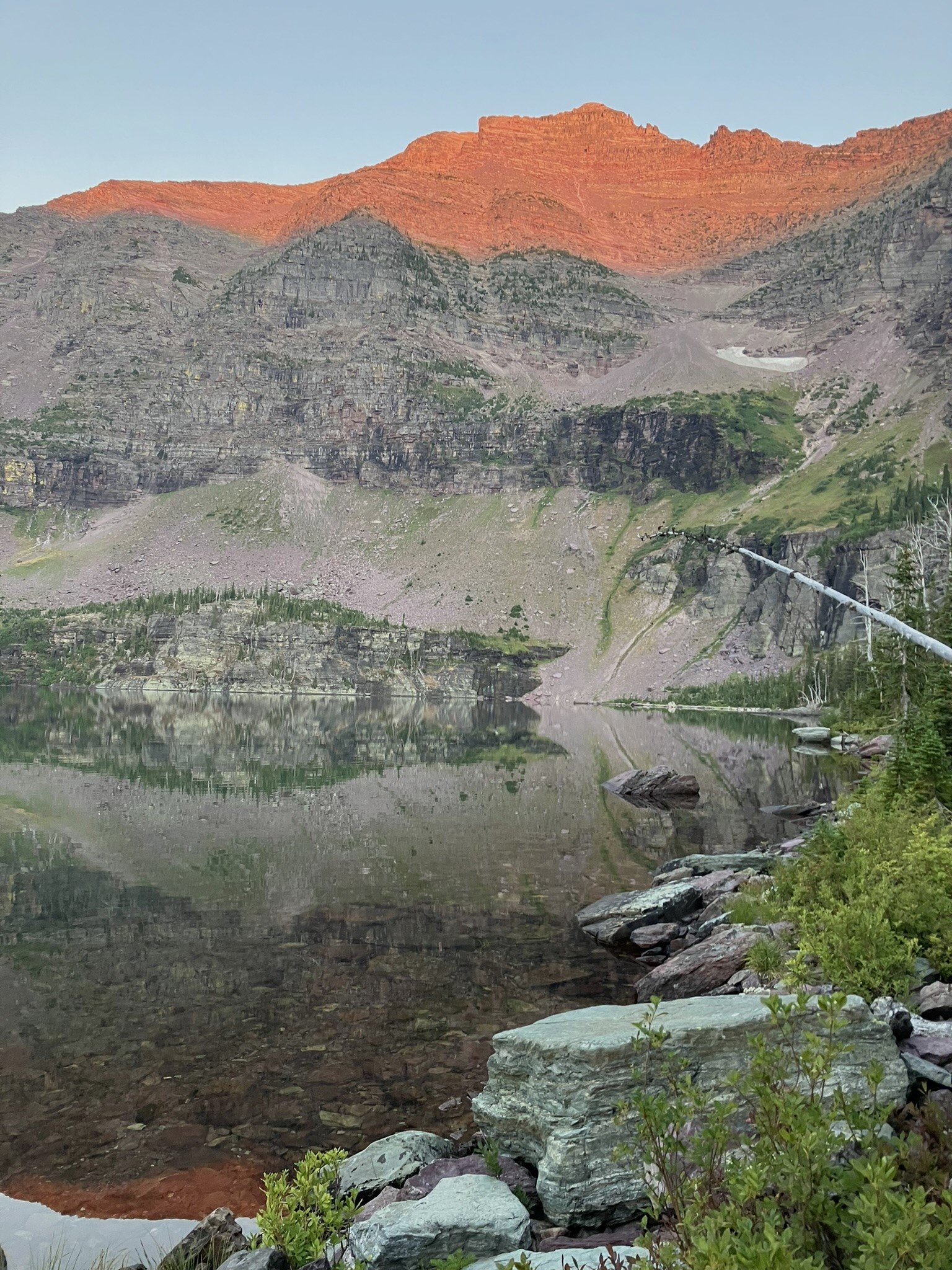
Looking from the SE, along Pinchot traverse
Day 2: To summit Mount Stimpson from the lake. it took us about 12 hours at a medium pace on a very hot day. After cruising up to Buffalo Woman Lake early in the morning via the trail, we headed up the obvious saddle that is NW of the lake. Once we left the brush down low, although steep and grassy, the segment to the pass was very attainable, and when we made it to the pass we had a great first break! From the pass at an elevation of approximately 7600’ you’ll find a relatively obvious (cairns) human trail that traverses around Mount Pinchot, just keep your eyes peeled! This was the hardest section in both directions due to the exposure and route finding. Spectacularly, the trail does lead you around the entire western face of Pinchot through dramatic rock out-croppings and through drainage after drainage. The trail eventually ends up at 7400’ and leads to the pass between Stimpson and Mount Pinchot. The views from this point remind you of the remoteness you can access in the park with some hard work. We stashed water at this pass before heading up to the summit of Stimpson. The exposure for most of the way up Stimpson is easy Class 3, with harder Class 3 the last 200’ to the summit ridge, with a total elevation gain of ~2,800’ from the pass. The views as you climb up and up become grander and grander - seeing Mount Pinchot in its entirety, including the very steep terrain that was below where you just traversed, seeing Stimpson creek to the E and the many lakes in that basin, in addition to snow pockets! While you summit the ridge on the NE side, the true summit is on the SW side, so if you’re looking to see both points, get ready for a 3’ Wide Ridge walk in some spots! Since Stimpson is the highest peak in the area, you are truly above everything else making it one of the most beautiful peaks in the park. We made it up, so now to make it down! As you climb down from the summit ridge- if you find yourself above steeper cliff sections that are challenging to get down (i.e. approaching class 4), you are not on the correct route. Refer to your GPS track or backtrack to find a safer route. It was a bit spookier traversing across Pinchot on the way back, since we got to view the cliffs you were actually above while on the summit and we were getting tired from the heat and sun. We descended back to our camp at Beaver Woman Lake exactly the same way, just with very tired legs.

Day 3: Luckily for the long summer days, we didn’t feel like we had to start early to head out to Two Medicine, we also weren’t all morning people and we got our butts kicked the day before! Being this remote in the park, we thought it would be fun to head out a different way. This is not required to summit Stimpson, but does allow more biodiversity and park terrain to be viewed. In the heat of mid- August, we crossed ample water sources and filled up every time, but were able to keep our packs lighter for the elevation gain. It took us a full 11 hours to make the route to the trailhead, where our ride was waiting. We went from Beaver Woman Lake, over Surprise pass (very unique terrain surrounding), then east towards Cut Bank Pass, and quickly over Pitamaken pass and descended down into Two Lake viewing the easter plains as we passed loads of huckleberries and large beetles.

Wildlife report: We startled a black bear by a water source on the way in- remember to be loud and aware near running water, especially on a hot, summer day! A grizzly bear startled us at a trickling water source above treeline on the way out. It got to about 15’ of us and just laid down in the brush next to the trail, panting, patiently waiting for us to get out of there.