The coast of Oregon

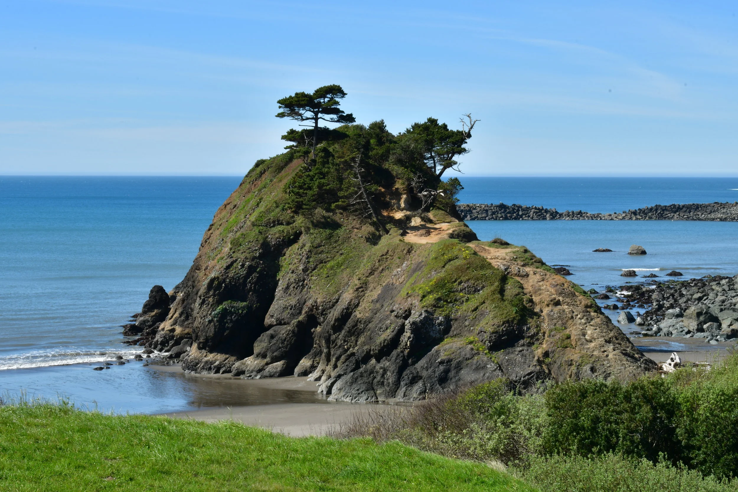
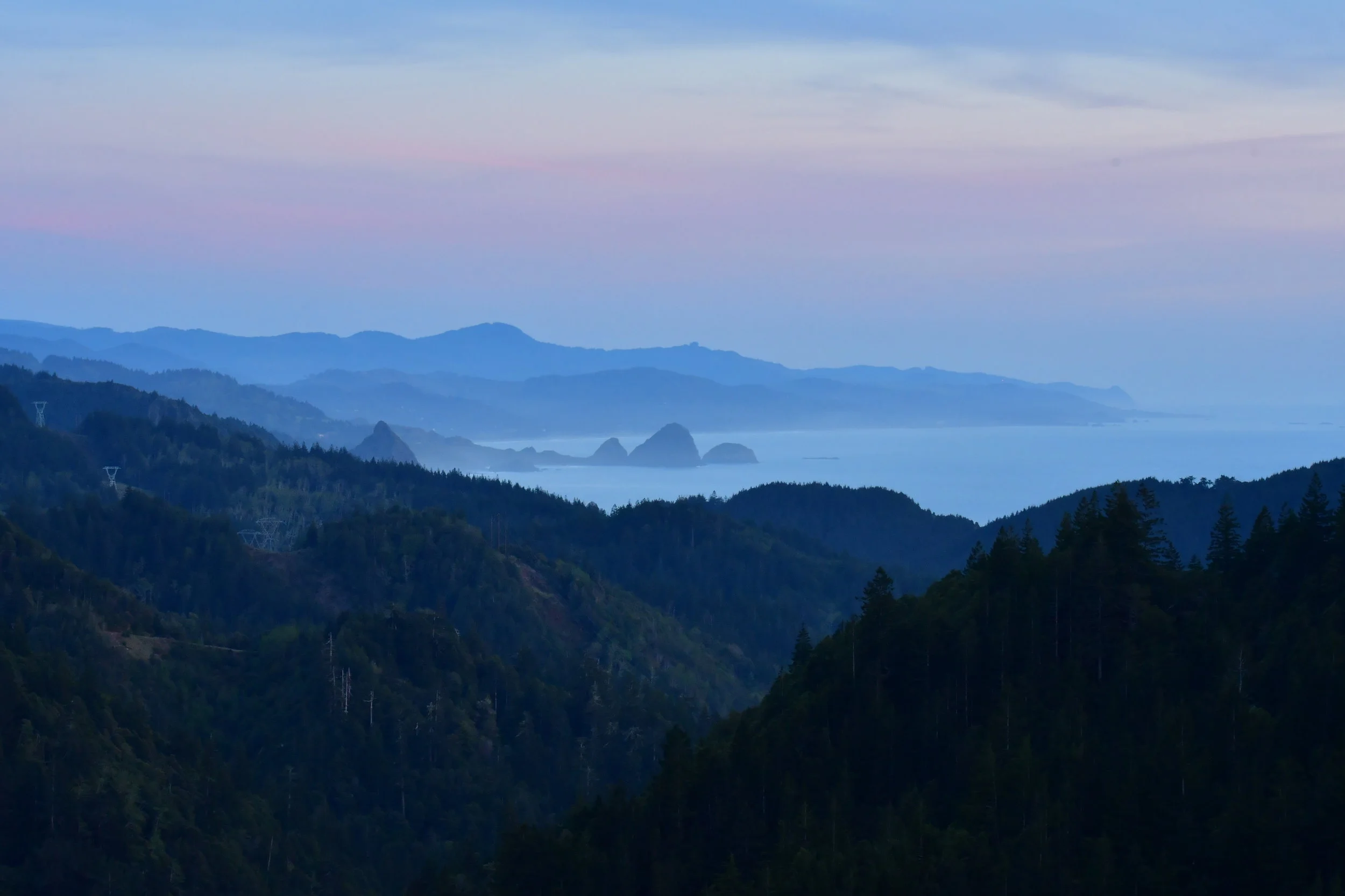
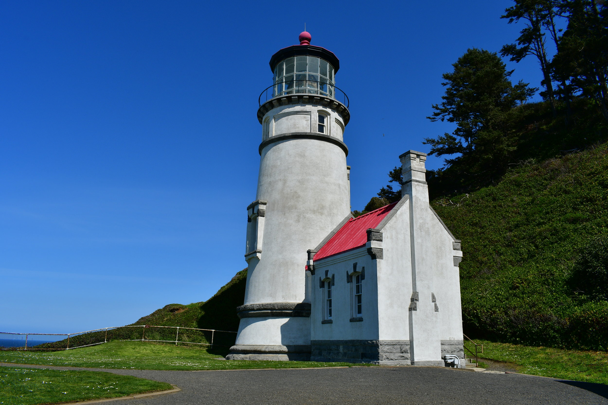
We drove up the Oregon coast, back along Hwy 1, making our way from the California coast to Portland. People speak very highly of the Oregon coast, and after visiting, we would agree. There were sections of cliffs, sandy beaches, crashing shores and lighthouses!

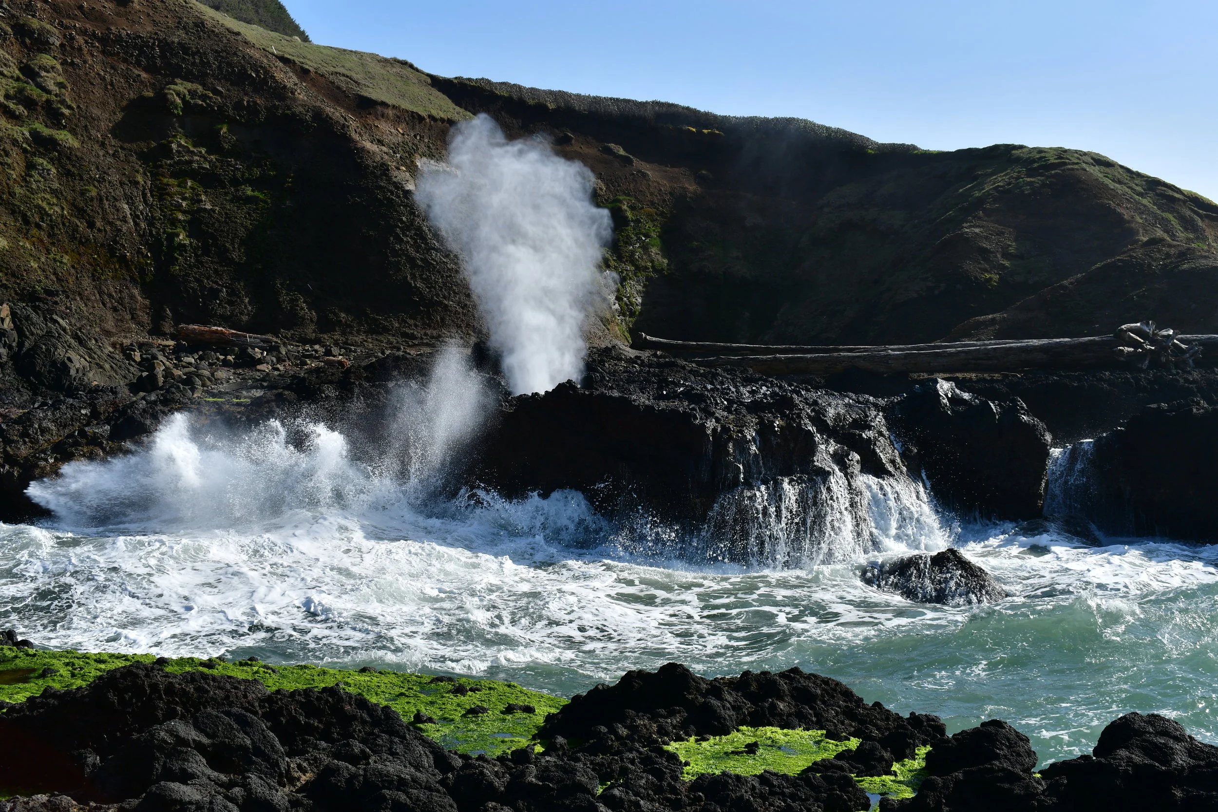
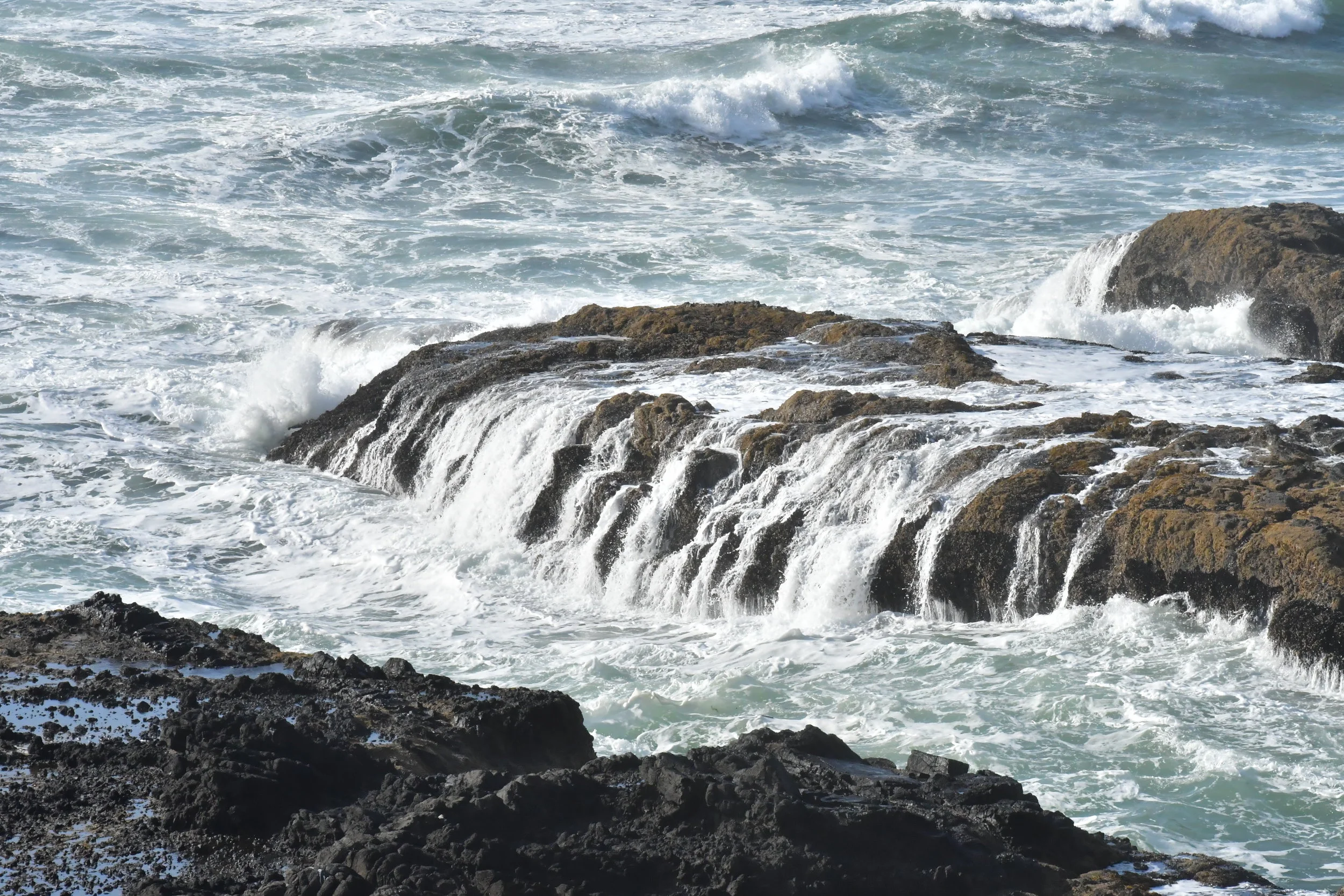
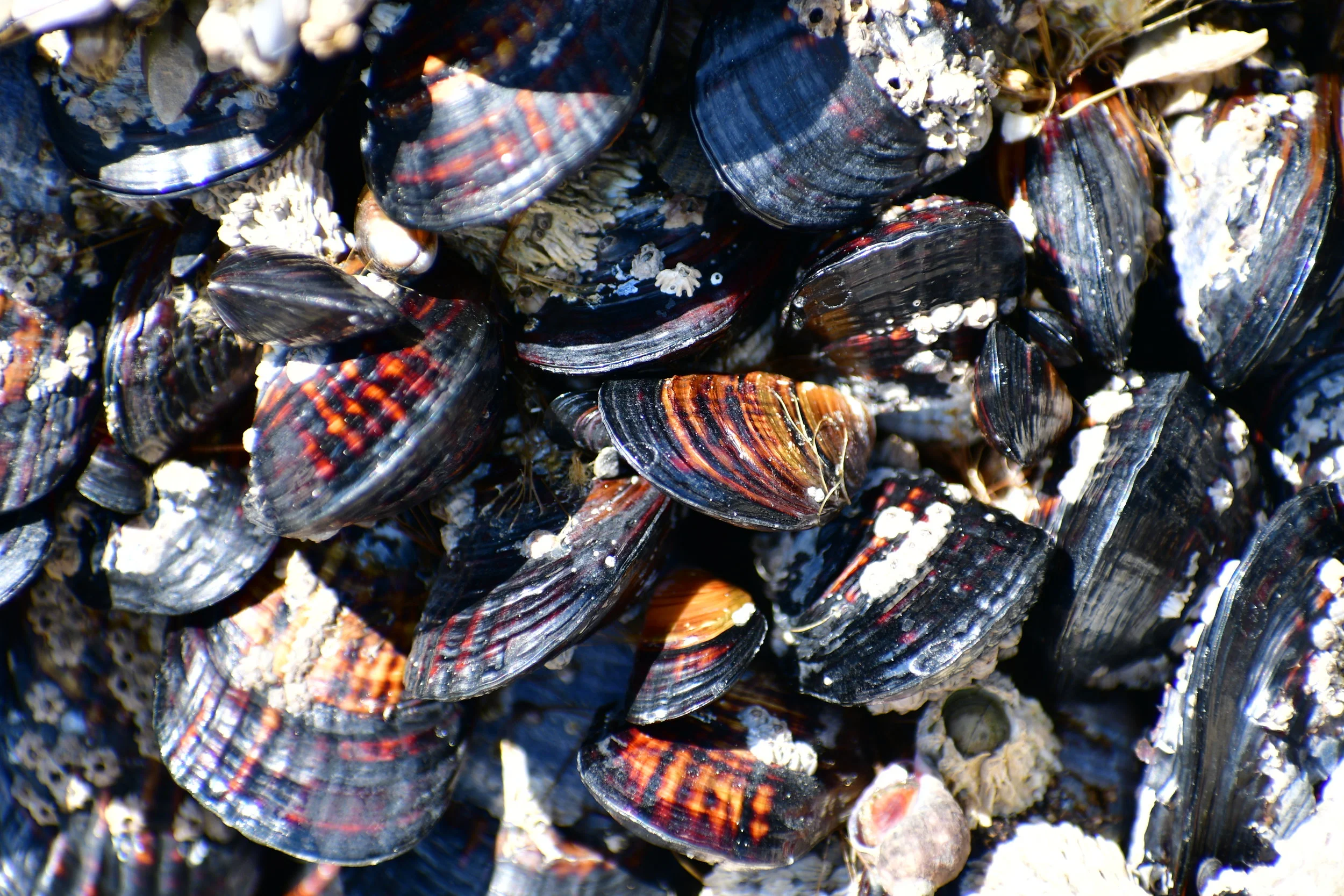
We spent a windy afternoon at the Oregon Dunes National Recreation Area, which was miles of sand dunes lining the coast. It was beautiful! To get out of the blowing sand, we camped the evening at a lagoon campground, which had a beautiful trail along the lagoon. Another highlight along the coast was Cape Perpetua, near the town of Yachats. The coast here was very rugged, which made high tide very exciting with the waves crashing into the varying shoreline. Some features included a 2 ft. wide channel, where water depths could change by 10 ft. in a second due to crashing waves; a blowhole that released the pressure through a hole in the rocks when a large wave crashed; a well (Thor’s well), which appeared to be a drain of ocean water. The combination of tide pools, sand beaches, and crazy coastline made this area awesome to explore.

Brentwood Bay, Vancouver Island, BC

We spent a day and a half exploring the Brentwood Bay area after taking the international ferry from Anacortes, WA to Sidney, BC. Along the 2.5 hour ride, we saw lots of birds, the San Juan Islands, and many boats! Taking the ferries has been a lot of fun and really easy!

In the Brentwood Bay area, we hiked in Gowlland Tod Provincial Park, which encompasses majority of the eastern coast of the Saanich Inlet. We hiked in the Gowlland Range, which are fjords towering 430 metres over Finlayson Arm (end of the Saanich Inlet), so we got to see some beautiful views. The next day we rented sea kayaks and kayaked around Todd Inlet and down the Finlayson Arm with calm waters all day. The wildlife highlight was seeing some river otters. We also saw some seals, jelly fish, and eagles throughout the day.

Traveling the California Coast

We spent about a week traveling north on Highway 1 along the California coast towards Oregon. The road was slower going than expected, but allowed us to enjoy the ocean views. For most of the coast, this road is right next to the ocean, making the road very windy, hilly, and it was full of pot holes! Highlights along the route included exploring the King Range National Conservation Area and hiking in the Redwoods! The King Range NCA is about a 30 mile stretch of wild coast, without any roads or development. We climbed King Peak, the highest point in the area, to see the ocean, surrounding mountains, and a distant snow covered volcano (Mt. Shasta). The next day, we hiked along the coast from Mattole Beach enjoying the waves crashing against the huge rocks spotting the shoreline. Watching the sunsets along the ocean brought bright colors to our evenings!

We finished our time in California by going to the Redwoods. Hiking among the massive tree giants made it feel unlike any other forest! Redwoods grow in groves, so transitioning from areas with ‘normal’ (they were still very tall) trees to the towering redwoods, brought us to wows! It was a great way to finish our time in California!

Point Reyes National Seashore, CA

Leaving the city behind, we headed towards Point Reyes National Seashore. In this area there were sandy beaches, coastal cliffs, green grasslands, and forested ridges. We spotted a lot of wildlife throughout the day, including elk, seals, and a coyote.

In the grasslands, there were Tule Elk, which are a subspecies of elk only found in California. We saw a herd of about 20 cows and another her of about 15 bulls. Seeing the massive antlers on the male elk was awesome! On the beach we saw Elephant seals were soaking up the sunshine. When walking past them on the beach, they barely acknowledged our presence. We enjoyed hiking along the wildflowers while seeing the distant coast line and the raging ocean.

Meet Pepper!

Many of you know we lost our dog, Atlas, in January in Montana. It was very tough for us to go through, but we were glad that we got to have her in our lives. While in California, we thought about getting another dog, and we found Pepper. After meeting her, it was an instant match! Her litter was found dumped on the side of the road, so we are glad she found her way to us. She’s 4 months old and has been a great teammate to join us;she is learning how to be a good adventure dog!

San Jose/San Francisco, CA

After spending a week in Tahoe, we were headed towards the ocean again! We spent a few days visiting one of my friends from high school in San Jose. With them, we explored the city and went surfing in Santa Cruz! It was really fun to try something new and enjoy the beach and sunshine! We were amazed how tiring the surfing made us, so went to a seafood shack to enjoy the local cuisine. With the warm temperatures, we enjoyed the shorts weather! On our way north, we didn’t spend too much time in San Francisco, but enjoyed crossing the Golden Gate Bridge on our way out of town!

Lake Tahoe, CA

From north-eastern California, we headed towards Lake Tahoe to ski our last days at the resorts. We skied at Northstar, Squaw Valley, Alpine Meadows, and Heavenly. Squaw was fun because it is an iconic ski resort, but Alpine Meadows and Heavenly were the highlight, because you could see the lake from the resorts and they had more exciting terrain. At Heavenly, we skied in California and Nevada in one day! It rained/snowed most of the week, so there was some interesting ski days in regards to weather! One day it went from warm with blue skies in the morning to snow and wind in the afternoon! We had to go back to the car to put on some warmer clothes!

Luckily there was a lot to explore in the area, which kept us busy. The Truckee River, which is fed from Lake Tahoe was raging due to spring melt and it was beautiful to walk along. We hiked along the north and south ends of the lake. We were glad to visit when we did, because we were between the winter and summer crowds, so the area was very quiet all week.

Lava Beds National Monument, CA

In Northwestern California, our first stop was the Lava Beds National Monument. We were not really sure what to expect, but were happily surprised when we spent two days caving in lava tunnels! Getting the opportunity to explore these caves alone was exhilarating! The caves were relatively easy to navigate with the help of a map. Actually traveling in the cave got tricky at times; at some points, we were crawling through areas that were about 3’ tall! The highlight was a cave called “Golden Dome.” The cave appeared to have a sparkling, gold covered ceiling and walls due to a bacteria that has water build up and reflects light. The result is absolutely stunning.

As we continue to travel, we are realizing that spring is here! This was great for us when we were visiting some waterfalls out of Branby, CA. It wasn’t so great when we tried to hike to some hot springs, but due to the high river levels, the hot springs were completely flooded! We are headed towards Lake Tahoe to get some spring skiing in!

Traveling through Oregon

We took about a week to drive through central OR. We spent a few days in Bend, OR and exploring the surrounding area. It rained about everyday we were in Oregon, which made exploring interesting! We hiked to the Tamolitch Blue Pool. The stunningly clear and blue water of this pool are the result of a river going underground, which was formed by lava flow 1,600 years ago. Another highlight out of Bend was skiing Mt. Bachelor. Luckily it was snowing at the ski area, but it made for no views of the volcanoes in the area! Once we made it to southern OR, the rainy weather slowed and we were able to watch thousands of birds on their migration routes! Next stop, California!

Onwards to Oregon!

After spending some time along the coast, we headed back into the mountains southwest of Seattle. We skied Crystal Mountain, which is near Mt. Ranier. Since this ski resort was surrounded by National Forest and National Park, camping nearby was very easy! One evening, when looking for our campspot, we came upon the Ranger Air Strip, which was a public airstrip that is open to aircraft camping! No planes landed when we were there, but we did see a few elk!

We drove about 4 hours south to Mount Saint Helens to meet up with some friends and ski the volcano. It was six miles to the summit of the volcano, but 6,000 feet elevation gain. It was a long, steep hike, but well worth it for the long ski down. At the summit, the skies were clear so we could see the mile wide crater and some surrounding volcanos in the distant. We were able to see Mt. Ranier, Mt. Hood, Mt. Jefferson, and Mt. Adams. Since the volcano peaks are much higher than any land surrounding them, they looked massive. The glaciers atop of most of them just increased their beauty and size! A few miles from the trailhead for Mount Saint Helens, there were the Ape Caves. We were able to hike, crawl, and climb 1.5 miles through a lava tunnel using only our head lamps! This was a great side trip and now we are off towards Oregon!